Unveiling the Ocean's Secrets: Marine Geophysics Technologies
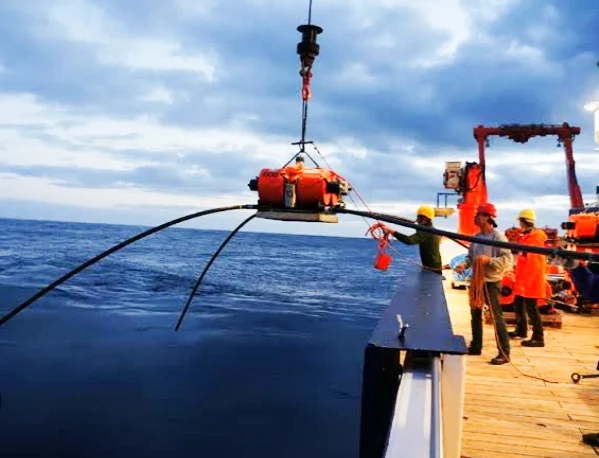
Marine geophysics is a field that uses geophysical techniques to study the Earth beneath the ocean floors. These technologies are used to understand seafloor topography, the structure and composition of the Earth's crust beneath the oceans, and potential resources that may lie on or beneath the seabed.
The vast expanse of the ocean holds countless mysteries, with its depths shrouded in darkness and pressure. Marine geophysics comes to the forefront, acting as a powerful tool for scientists and researchers to peer beneath the waves and uncover the secrets buried within.
Table of Specification: Marine Geophysics Technologies
This table outlines the key topics covered in the article "Unveiling the Ocean's Secrets: Marine Geophysics Technologies" and the specific technologies mentioned.
| Learning Objectives | Content Areas | Technologies |
|---|---|---|
| Explain the purpose of marine geophysics | Introduction | - Unveiling ocean secrets |
| Describe how marine geophysics maps the seafloor | Bathymetry | - Sound waves for depth measurement |
| Identify technologies for imaging the seabed | Side-scan sonar | - Sound pulses for seabed features |
| Explain how marine geophysics explores beneath the surface | Seismic reflection profiling | - Sound waves for sub-bottom imaging |
| List key technologies used in marine geophysics | - | - Gravity meters |
| - Magnetometers | ||
| - Autonomous Underwater Vehicles (AUVs) | ||
| Discuss the applications of marine geophysics | - | - Energy exploration |
| - Mineral exploration | ||
| - Geohazard assessment | ||
| - Cable & pipeline route planning | ||
| - Underwater archaeology |
Note: This is a basic table of specification and can be further expanded to include specific details about each technology, its operating principle, or even the limitations of each method.
This field utilizes a unique blend of established geophysical techniques, commonly used on land, and cutting-edge technologies specifically designed for the marine environment. By harnessing these tools, marine geophysics grants us the ability to:
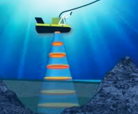
- Map the Seafloor: Bathymetry, a fundamental technique, employs sound waves to measure the ocean's depth, creating detailed maps of the underwater terrain.
- Image the Seabed: Side-scan sonar acts like an underwater eye, emitting sound pulses that paint a picture of the seafloor, revealing features like shipwrecks and geological structures.
- Probe Beneath the Surface: Seismic reflection profiling utilizes sound waves to penetrate the ocean floor, creating a cross-sectional image of the sub-bottom layers, similar to an X-ray of the Earth. This allows us to understand the composition and history of the seabed.
These are just a few examples of the diverse technologies within the marine geophysics arsenal. Here's a glimpse into some of the key players:
- Gravity Meters: Measure minute variations in Earth's gravitational pull, revealing information about the density of underlying rocks and potential resource deposits.
- Magnetometers: Detect variations in Earth's magnetic field, which can indicate the presence of different rock types or even shipwrecks.
- Autonomous Underwater Vehicles (AUVs): These unmanned robotic submarines can be equipped with various geophysical sensors, allowing for efficient and cost-effective data collection across vast ocean expanses.
Marine geophysics plays a crucial role in various sectors:
- Energy Exploration: Locating oil, gas, and even natural gas hydrates trapped beneath the seabed.
- Mineral Exploration: Identifying valuable mineral deposits on the ocean floor.
- Geohazard Assessment: Mapping potential hazards like underwater landslides and tsunamis.
- Cable and Pipeline Route Planning: Ensuring the safety and stability of subsea infrastructure.
- Underwater Archaeology: Unveiling the secrets of shipwrecks and submerged settlements.
As technology continues to evolve, so too will the capabilities of marine geophysics. With the development of even more sophisticated instruments and data processing techniques, we can expect to unlock an even deeper understanding of our planet's hidden ocean realm.
Unveiling the Champions: Leader Country in Marine Geophysics Technologies
The vast ocean depths hold immense potential, but unlocking their secrets requires cutting-edge technology. Marine geophysics plays a vital role, and several countries are at the forefront of developing and deploying these innovative tools. Determining a single "leader" can be complex, as strengths often vary across specific technologies or applications.
Leading Countries in Marine Geophysics Technologies
The vast ocean depths hold immense potential, but unlocking their secrets requires cutting-edge technology. Marine geophysics plays a vital role, and several countries are at the forefront of developing and deploying these innovative tools. Determining a single "leader" can be complex, as strengths often vary across specific technologies or applications. However, let's explore some key players in the exciting world of marine geophysics, along with some leading companies in each country:
| Country | Strengths | Leading Companies |
|---|---|---|
| United States | Long history, robust infrastructure | NOAA, Scripps Institution of Oceanography, https://www.cgg.com/ |
| Japan | Earthquake & tsunami hazard assessment, deep-sea AUVs | JAMSTEC, The University of Tokyo |
| European Union (EU) | Collaborative research, sustainable exploration, environmental monitoring | GEOMAR Helmholtz Centre for Ocean Research Kiel, Kongsberg Maritime |
| China | Rapidly emerging, resource exploration, geohazard assessment | CNOOC, China Geological Survey |
| Canada | Arctic geophysics, resource exploration | Geological Survey of Canada |
| South Korea | Resource exploration, infrastructure development | Korea Institute of Geoscience and Mineral Resources |
| Australia | Resource exploration, strong capabilities | CSIRO |
Note: This table provides a brief overview, and there are many other companies involved in marine geophysics technologies within each country.
Let's explore some key players in the exciting world of marine geophysics:
United States:
- Possesses a long history and robust infrastructure for marine geophysical research.
- Renowned institutions like the National Oceanic and Atmospheric Administration (NOAA) and the Scripps Institution of Oceanography contribute significantly.
- American companies are leaders in developing advanced technologies like sophisticated AUVs and seismic exploration tools.
Japan:
- Holds a strong position in marine geophysics, particularly in areas like earthquake and tsunami hazard assessment.
- Japanese research institutions and shipbuilders are at the forefront of developing AUVs capable of operating in challenging deep-sea environments.
- The country excels in data processing and interpretation, leading to valuable insights from collected geophysical data.
European Union (EU):
- Through collaborative efforts within the EU, European nations possess a powerful collective force in marine geophysics.
- Focuses on research initiatives aimed at sustainable resource exploration, environmental monitoring, and marine infrastructure development.
- European companies are leaders in the development of sophisticated sonar technologies and underwater sensor systems.
China:
- Rapidly emerging as a major player due to significant investments in marine research and development.
- Chinese institutions are actively involved in exploring their vast maritime territory, furthering their understanding of seabed resources and geohazards.
- China is actively developing its own marine geophysical technologies, aiming to reduce dependence on foreign solutions.
Other Notable Players:
- Canada: Holds expertise in Arctic marine geophysics and resource exploration in harsh environments.
- South Korea: Similar to China, experiencing rapid growth in its marine geophysics sector, focusing on resource exploration and infrastructure development.
- Australia: Possesses strong capabilities in marine geophysics due to its vast coastline and dependence on marine resources.
While these are some of the leading countries, it's important to acknowledge the global nature of marine geophysics research. Collaborative efforts between nations often lead to significant breakthroughs. The future holds promise for continued international cooperation and advancements in marine geophysical technologies, further unlocking the mysteries of the ocean depths.
Frequently Asked Questions About Marine Geophysics Technologies
Marine geophysics is a branch of geophysics that studies the physical properties of the ocean floor and its underlying structures. It involves a wide range of techniques to explore the ocean's depths and understand its geological processes. Here are some common questions and answers about marine geophysics technologies:
Basic Concepts
- What is marine geophysics?
- Marine geophysics is the study of the physical properties of the ocean floor and its underlying structures.
- What are the main branches of marine geophysics?
- The main branches are marine seismology, marine gravity, marine magnetism, and marine electrical resistivity.
Geophysical Methods
- What is marine seismic exploration?
- Marine seismic exploration uses sound waves to create images of the ocean floor and subsurface structures. It is widely used in oil and gas exploration.
- What is marine gravity surveying?
- Marine gravity surveying measures variations in the Earth's gravitational field over the ocean to detect subsurface structures. It is used in mineral exploration and studies of the ocean crust.
- What is marine magnetic surveying?
- Marine magnetic surveying measures variations in the Earth's magnetic field over the ocean to detect magnetic minerals and subsurface structures. It is used in mineral exploration and studies of the ocean crust.
- What is marine electrical resistivity surveying?
- Marine electrical resistivity surveying measures the resistance of the ocean floor to electrical current. It is used in studies of the ocean crust and sediment distribution.
Applications of Marine Geophysics
- How is marine geophysics used in oil and gas exploration?
- Marine geophysics is used to locate oil and gas reservoirs using seismic exploration.
- How is marine geophysics used in mineral exploration?
- Marine geophysics is used to locate mineral deposits using various methods, including gravity, magnetic, and electrical resistivity surveys.
- How is marine geophysics used in oceanography?
- Marine geophysics is used to study the structure and dynamics of the ocean crust, sediment distribution, and plate tectonics.
- How is marine geophysics used in environmental studies?
- Marine geophysics is used to study the ocean floor's environmental conditions, such as pollution and sedimentation.


