Unveiling Earth's Secrets: Gravity & Magnetic Surveys
Geologists have a toolbox full of techniques to peer beneath the Earth's surface. Among these are gravity and magnetic surveys, powerful tools that exploit natural variations in Earth's gravity and magnetic fields to map geological structures and features hidden from sight.
Gravity & Magnetic Surveys table
| Feature | Gravity Surveys | Magnetic Surveys |
|---|---|---|
| Measurement | Variations in Earth's gravitational pull | Variations in Earth's magnetic field |
| Underlying Property | Density of rocks and minerals | Magnetic properties of rocks and minerals |
| Useful for Detecting | Dense ore bodies, buried structures, variations in rock types | Magnetic minerals, geological structures |
| Applications | Mineral exploration, oil & gas exploration, hydrocarbon exploration, geological mapping, environmental studies, archaeology | Mineral exploration, geological mapping, environmental studies |
| Advantages | Relatively low-cost, quick over large areas, non-invasive | Relatively low-cost, quick over large areas, non-invasive |
Going Passive: Nature's Clues
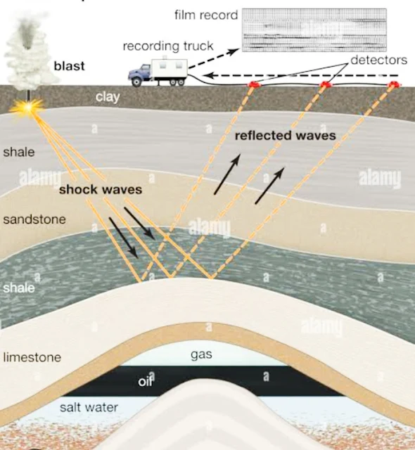
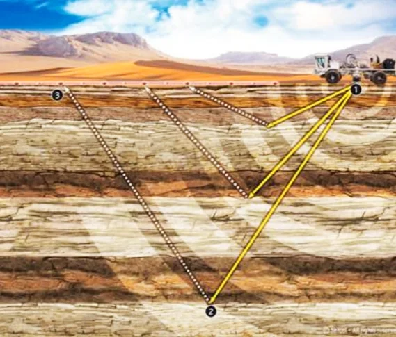
Unlike seismic surveys that use sound waves, gravity and magnetic surveys are passive techniques. They don't involve any controlled sources. Instead, they measure the subtle variations in Earth's existing gravitational and magnetic fields caused by differences in the density and magnetic properties of rocks and minerals underground.
Gravity's Pull: Denser Rocks, Stronger Signal
Gravity surveys measure tiny variations in Earth's gravitational pull. Denser rocks exert a stronger gravitational attraction, causing slight anomalies in the Earth's gravity field. These anomalies can reveal the presence of dense ore bodies, buried structures, or even variations in rock types.
Magnetic Fields and Hidden Riches
Magnetic surveys, on the other hand, measure variations in Earth's magnetic field. Certain rocks and minerals are more magnetic than others. Magnetic surveys can detect these variations, providing clues about the underlying geology. This can be particularly useful in mineral exploration, where magnetic minerals like iron ore can be pinpointed.
Benefits and Applications
Gravity and magnetic surveys offer several advantages. They are relatively low-cost compared to other techniques and can be conducted over large areas quickly. They are also non-invasive and environmentally friendly.
These surveys have a wide range of applications, including:
- Mineral Exploration: Identifying potential deposits of valuable minerals and metals.
- Oil & Gas Exploration: Mapping subsurface structures that might trap oil and gas reserves.
- Hydrocarbon Exploration: Understanding the distribution of groundwater resources.
- Geological Mapping: Creating detailed geological maps of an area.
- Environmental Studies: Detecting buried hazardous waste or locating potential sites for geological CO2 storage.
- Archaeology: Finding buried structures and archaeological features.
Here's a table outlining some well-regarded companies with a presence in gravity and magnetic surveys:
| Company | Area of Focus | Additional Notes |
|---|---|---|
| Schlumberger Ltd. | Broad range of geophysical services, including gravity and magnetics | Major player in the oil and gas industry |
| CGG SA | Geophysical services company offering gravity and magnetic surveys | Strong international presence |
| BGP (China National Petroleum Corporation) | Geophysical services for the oil and gas industry | Particularly active in Asia |
| Fugro | Geotechnical and geophysical services company | Offers gravity and magnetics alongside other surveys |
| EDCON-PRJ, Inc. | Specializes in gravity and magnetic surveys | Known for expertise in data acquisition, processing, and interpretation |
Additional factors to consider when choosing a company:
- Project type and size: Different companies may specialize in smaller or larger projects, or cater to specific applications like mineral exploration or environmental studies.
- Geographic expertise: Some companies may have a strong presence in certain regions.
- Technology and innovation: Look for companies that invest in cutting-edge technology for data collection and interpretation.
- Client service and reputation: Positive client experiences and a strong reputation are important factors.
Seeing Beyond the Surface
By measuring these subtle variations in Earth's natural fields, gravity and magnetic surveys offer a valuable window into the hidden world beneath our feet. These techniques continue to play a vital role in our quest to understand and explore the geological makeup of our planet.
High-Tech Tools: Gravity & Magnetic Surveys Technology
Technology Used in Gravity & Magnetic Surveys
| Feature | Technology | Benefit |
|---|---|---|
| Gravity Measurements | Superconducting Gravimeters | Highly precise measurements of Earth's gravitational pull, leading to detailed subsurface maps. |
| Positioning | GPS Technology | Precise location data for gravity measurements, creating robust datasets. |
| Magnetic Surveys | Airborne Magnetometers (planes/drones) | Rapid exploration of large areas, creation of high-resolution magnetic anomaly maps. |
| Multi-Sensor Probes | Integrated Gravity & Magnetic Sensors | Simultaneous measurement of both fields, providing a more comprehensive view. |
| Data Processing | Geophysical Software | Filtering and analyzing large datasets, identifying anomalies and building 3D subsurface models. |
| Data Interpretation | Powerful Computing | Complex modeling techniques for accurate interpretations of geological features. |
| Integration | Combined Geophysical Techniques (e.g., Seismic) | Combining data sources for a more complete understanding of the subsurface. |
| Future: Automation | Automated Data Collection & Processing | Streamlined surveys, reduced human error. |
| Future: Machine Learning | Machine Learning Algorithms | Faster and more accurate data interpretations through pattern recognition. |
The quest to understand what lies beneath the Earth's surface has fueled innovation in geophysical techniques. Gravity and magnetic surveys, while based on fundamental principles, have seen significant advancements in technology, making them powerful tools for geologists and explorers.
Gravity Goes Digital: Precise Measurements
Gone are the days of cumbersome pendulums. Modern gravity surveys rely on highly sensitive gravimeters, often utilizing superconducting technology. These instruments can detect incredibly minute variations in Earth's gravitational pull, leading to more accurate and detailed maps of the subsurface. Additionally, advancements in GPS technology allow for precise positioning of measurements, creating a more robust data set for analysis.
Magnetic Marvels: Airborne Surveys and Advanced Sensors
Magnetic surveys have also benefited from technological leaps. Traditionally, ground-based magnetometers were used, but these were limited in their coverage area. Today, airborne surveys with magnetometers mounted on airplanes or drones are commonplace. This allows for rapid exploration of vast regions and the creation of high-resolution magnetic anomaly maps. Advancements in sensor technology have led to the development of multi-sensor probes that can simultaneously measure gravity and magnetic fields, providing a more comprehensive picture of the subsurface.
Data Power: Processing and Interpretation
The true power of these surveys lies not just in the data collection but also in its processing and interpretation. Sophisticated software allows geophysicists to filter and analyze vast amounts of data, identifying subtle anomalies and building 3D models of the subsurface. Powerful computing allows for complex modeling techniques, leading to more accurate interpretations of the geological features responsible for the observed variations.
Integration is Key: Combining Technologies
Gravity and magnetic surveys are often used in conjunction with other geophysical techniques like seismic surveys. By integrating data from different sources, geologists can gain a more complete understanding of the subsurface. This collaborative approach allows for a more confident identification of potential mineral deposits, oil and gas reserves, or even archaeological sites.
The Future of Exploration: Automation and Machine Learning
The future of gravity and magnetic surveys is bright, with automation and machine learning playing an increasingly important role. Automated data collection and processing workflows can streamline surveys and reduce human error. Machine learning algorithms can be trained to identify patterns in geophysical data, leading to faster and more accurate interpretations.
Technology Drives Discovery
By leveraging cutting-edge technology, gravity and magnetic surveys are no longer limited to basic anomaly detection. They have become powerful tools for creating detailed geological maps, pinpointing valuable resources, and understanding the hidden structures that shape our planet. As technology continues to evolve, these surveys will remain at the forefront of our quest to unlock the secrets buried beneath our feet.
Frequently Asked Questions About Gravity and Magnetic Surveys
Gravity and magnetic surveys are geophysical methods used to measure variations in the Earth's gravitational and magnetic fields. These variations can provide information about the subsurface structure and composition. Here are some common questions and answers about these techniques:
Basic Concepts
- What is gravity surveying?
- Gravity surveying measures variations in the Earth's gravitational field. These variations can be caused by differences in the density of subsurface materials.
- What is magnetic surveying?
- Magnetic surveying measures variations in the Earth's magnetic field. These variations can be caused by the presence of magnetic minerals.
Applications of Gravity and Magnetic Surveys
- What are the main applications of gravity and magnetic surveys?
- These surveys are used in a variety of fields, including:
- Mineral exploration: Locating mineral deposits.
- Oil and gas exploration: Identifying potential hydrocarbon reservoirs.
- Geotechnical engineering: Assessing subsurface conditions for construction projects.
- Archaeology: Locating archaeological sites.
- Environmental studies: Monitoring groundwater contamination and soil pollution.
- These surveys are used in a variety of fields, including:
- How are gravity and magnetic surveys used in mineral exploration?
- Different minerals have different densities and magnetic properties. By measuring variations in the gravitational and magnetic fields, it is possible to identify areas with potential mineral deposits.
Challenges and Limitations
- What are the challenges of conducting gravity and magnetic surveys?
- Challenges include:
- Noise: Noise from various sources, such as topography and atmospheric effects, can interfere with measurements.
- Data interpretation: Interpreting gravity and magnetic data can be complex and requires specialized knowledge.
- Cost: Conducting gravity and magnetic surveys can be expensive, especially for large areas.
- Challenges include:
- What are the limitations of gravity and magnetic surveys?
- Gravity and magnetic surveys are limited by their depth of penetration, which depends on the density and magnetic properties of the subsurface materials.
Future Directions
- What are the future directions of gravity and magnetic surveys?
- Future directions include:
- Development of new sensors: Developing more sensitive and accurate gravity and magnetic sensors.
- Integration with other geophysical methods: Combining gravity and magnetic surveys with other geophysical techniques, such as seismic and electrical resistivity surveys.
- Automation: Developing automated gravity and magnetic survey systems to improve efficiency and reduce costs.
- Future directions include:


